
4.9/5
( 629+ reviews)
Features GISMobil TMGA
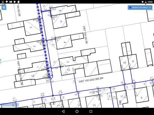
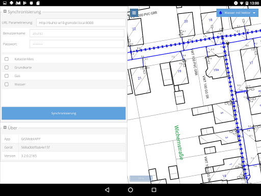
This app enables the map display of line documentation in offline and online mode.
The data is provided by a GISMobil WEB map server.
For offline mode, the mobile device receives the data via a synchronization process.
The representation of the offline data can contain both raster data and vector data.
Furthermore, WMS / WMTS sources can also be integrated in online operation.
🎮
Gaming Features
Enjoy immersive gaming experience with various game modes.
🏠
Smart Home
Control and monitor your home with smart features.
📥
Offline Mode
Use the app without an internet connection. Your data syncs when you're back online.
Screenshots
See the GISMobil TMGA in Action

Get the App Today
Download on Google Play
Available for Android 8.0 and above